Our straitegic planning and scheduling ensure there is no time delay in the project. Our teams’ expertise and experience help us cut costs on reworks. This helps us maintain our competitive pricing.
Our commitment to quality, precision, and innovation ensures that your projects are supported with the most reliable geospatial data and insights.
To maintain the greatest quality and security in the sector, we regularly update all of our hardware and software. Together with our robust cyber hygiene, this provided excellent data security.
Our expert team delivers precise, high-resolution mapping and geospatial solutions to support various industries. Committed to innovation and accuracy, we help clients achieve superior project outcomes through advanced technology and unparalleled expertise.
We have 10+ years of proven track record in the GIS services, LiDAR and Software developement industry
Read MorePrecision drone and DGPS surveys for accurate mapping and site analysis. Offering high-resolution imagery solutions to enhance project planning and decision-making.
Read MoreWe have 100+ happy clients to whom we have sucessfully delivered our softwares and services accross the globe
Read MoreWe are able to provide our expert services across the world because to a strong focus on research, technical expertise, and innovation, as well as a team of dedicated and professional experts. GIS Software solutions, CAD and Drafting designs, IT infrastructure services, surveillance, urban planning, GIS, and engineering design services are some of our expertise. We combine these specialties with our expertise to provide high quality, timely, professional services with precise and valuable solutions.
Technology-focused GIS services are offered by Tecnoglance. With the help of our professional technical experts, we strive to offer excellent and cutting-edge GIS-based solutions.
Read MoreWith over a thousand clients worldwide, Tecnoglance has extensive market knowledge and experience in the telecom sector.
Read MoreNavigational aids to enhance driving security and convenience. The correct combination of on-site and off-site (field) teams allows Tecnoglance an end-to-end solution provider in the mapping and navigation geo-content domain.
Read MoreProduction and globalization, two of the most crucial pillars for the development of a robust economy, are elevated by Tecnoglance. To assist clients in creating cutting-edge products, Tecnoglance makes use of its expertise in creating navigational information.
Read MoreThe business has established itself as a global supplier of CAD solution providers, CAD design & drafting services, and construction companies, builders, engineers, and contractors.
Read MoreSoftware like e-Commerce, Pharmaceutical Management, Hospital Management, and Billing software are among the bespoke solutions offered by Tecnoglace.
Read MoreWe have been at the forefront of revolutionizing the way spatial data is collected, analyzed, and utilized across various industries. Through our advanced Lidar technology, we have successfully conducted high-precision 3D mapping projects, providing our clients with detailed and accurate geospatial information for better decision-making.

Mar 29, 2020
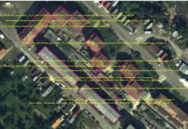
Our team of skilled GIS professionals has diligently worked to ensure the accuracy and completeness of the data. We have updated information such as building footprints, heights, roof types, materials, and other relevant attributes. This comprehensive dataset serves as a valuable resource for urban planning, infrastructure development, disaster management, and various other applications..
Read More
Aug 12, 2022
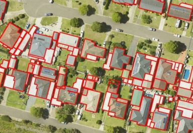
We have successfully captured and extracted orthogonal building footprints from satellite imagery in New South Wales, Australia. Using state-of-the-art image processing techniques and advanced algorithms, we have accurately delineated the boundaries of buildings across the region....
Read More
Jan 16, 2023
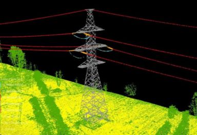
With Lidar technology, we can capture detailed 3D information, including the position, height, and shape of power lines. This data aids in the analysis of line sag, clearance issues, and vegetation encroachment, allowing electrical departments to take proactive measures to prevent outages and improve system performance...
Read More